Recently, I discovered how fascinating topographic maps are, and, well, I got a little obsessed. Those elevation lines? They look like art. Beautiful, intricate, mesmerizing.
So, on one of those weekends when stepping outside felt like a bad idea because of wildfire smoke making the air unbreathable, COVID still lurking, and a general 2020 apocalypse vibe, I got inspired. I decided to create a projection of what Florianópolis would look like if the sea level rose by 15 meters. Spoiler: it’s a vibe, but not the good kind.
With some help from the crew (Lê, Manu, Jordane, and Augusto), I gave the newly-formed islands and regions their own names. It was oddly fun, considering the grim premise.
I used a site called FloodMap to make the projection. It’s pretty basic and doesn’t account for things like currents, erosion, wind, or the inevitable chaos we humans will add to the mix. Even so, it was fascinating to see the island split in two. Maybe, just maybe, that’s the perfect excuse to finally shed the “Floriano” legacy. (Locals, you get it.)
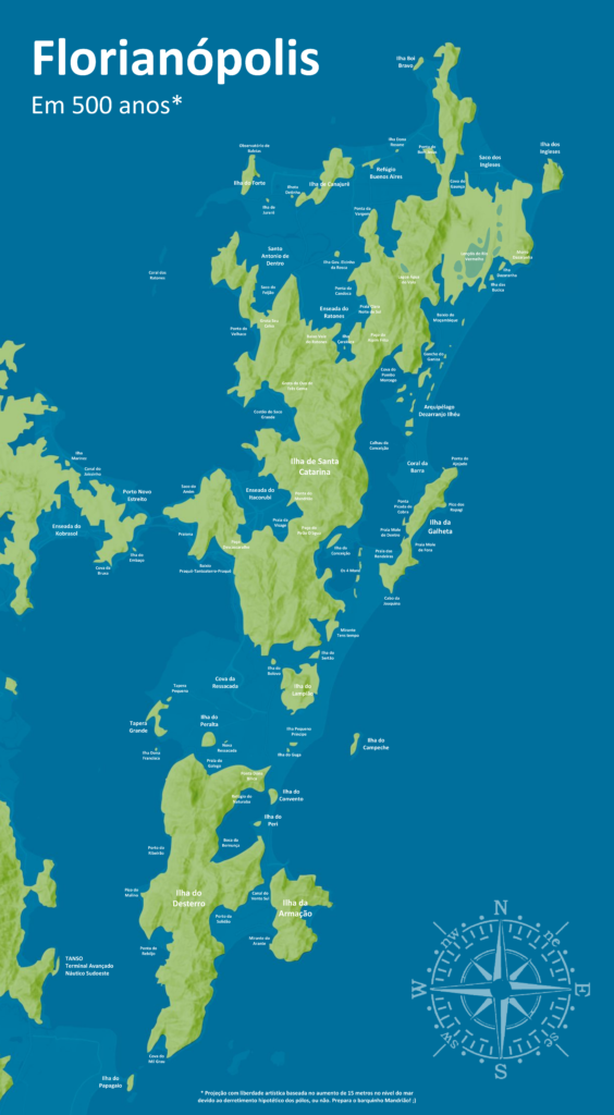
This little exercise got me thinking: in 500 years, the world will look wildly different. Technologies for housing and transportation could make life surprisingly livable, even in a scenario like this. Think vertical farms, floating neighborhoods, maybe even underwater condos. Humans are pretty good at adapting when we’re not busy messing things up.
Anyway, here’s the link to the high-resolution map. Use it, edit it, have fun with it. Or don’t. I’m not your boss.